About All Tours Boat ToursFrom Medellin ToursPiedra del Peñol ToursHelicopter Ride ToursPrivate Tours Directions Hours & Fees
Find Tours 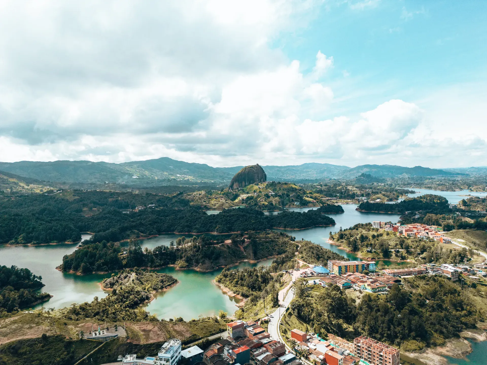
Guatape sits 79 kilometers northeast of Medellín, defined by a 220-meter granite monolith and a vast artificial reservoir. The town features brightly painted buildings decorated with bas-relief tiles called zócalos.
Guatape occupies a high-altitude valley in the Andes, 79 kilometers northeast of Medellín. A 220-meter granite monolith, La Piedra del Peñol, dominates the landscape. Two-thirds of this 65-million-year-old rock sits below ground, while the exposed peak towers over a sprawling, man-made reservoir. Visitors climb 740 concrete steps built directly into a vertical fissure on the rock's face to reach the 1,890-meter summit.
The town center sits on the shores of the Peñol-Guatapé Reservoir. Brightly painted bas-relief tiles, known as zócalos, cover the lower halves of nearly every building. These hand-crafted squares depict local trades, regional flora, and community events. Calle del Recuerdo preserves the oldest original zócalos, saved by residents before a 1970s hydroelectric project flooded the original agricultural valley. Restaurants along the waterfront serve traditional plates of Trucha Frita, catching the trout directly from the lake and frying it crisp alongside plantains and avocado.
Navigating the area requires physical stamina and careful timing. The steep, narrow stairs of the monolith become slick and hazardous during heavy afternoon downpours, particularly from March through May. Wheelchair access remains highly limited due to cobblestone streets and steep inclines. Travelers should arrive at the rock's ticket office before 9:00 AM to avoid the daily influx of 2,000 peak-season visitors. The site operates from 8:00 AM to 5:00 PM and only accepts Colombian Pesos in cash for the COP 20,000 entry fee.
Indigenous Tahamí people inhabited the Eastern Antioquia region long before Spanish colonization in the 16th century. They worshipped the giant granite monolith, calling it 'mojarrá'. A local chief named Guatapé governed the territory, a name translating to 'stones and water' in the Quechua language. Spanish colonizers grouped these indigenous populations into the San Antonio de Remolinos Peñol shelter in 1714. Archaeologists later uncovered clay urns and artifacts in the nearby Alto Verde sector, confirming early settlements.
Don Francisco Giraldo y Jimenez officially founded the town on October 4, 1811. The settlement grew slowly as an agricultural hub, relying on farming and livestock. The Colombian government declared La Piedra del Peñol a national monument in the 1940s, recognizing its geological importance. Guatapé operated as a quiet farming municipality until a massive infrastructure project permanently altered its geography.
Empresas Públicas de Medellín constructed the Peñol-Guatapé hydroelectric dam in the 1970s. The resulting reservoir flooded the old town of El Peñol and vast tracts of Guatapé's agricultural land. Residents were forced to relocate to higher ground. This dramatic geographical shift destroyed the traditional farming economy but created a massive navigable lake. The community pivoted to tourism, leveraging the new waterfront and the towering monolith.
Today, the hydroelectric complex generates a significant portion of Colombia's electricity. The flooded valley conceals the ruins of old fincas and estates, including Pablo Escobar's former mansion, La Manuela, which was bombed in 1993. Boat tours now navigate directly over the old agricultural fields. Visitors taking the two-hour bus ride from Medellín's Terminal del Norte should purchase return tickets immediately upon arrival, as evening transport frequently sells out.
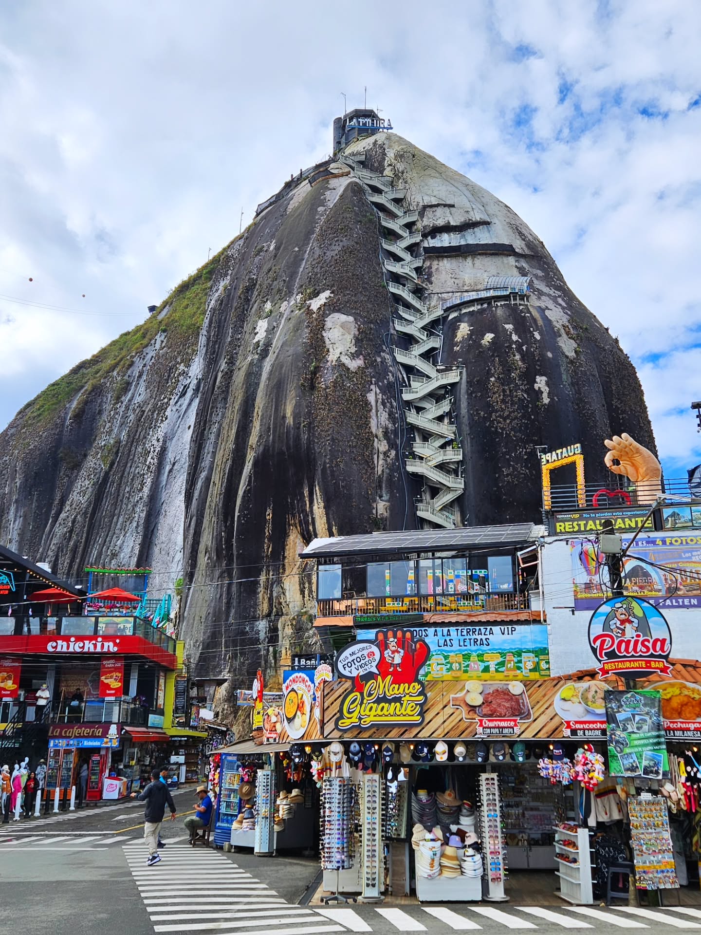
El Peñón de Guatapé formed 65 million years ago along the Antioquia Rock Base. The 220-meter granite monolith weighs an estimated 10 million tons. Only one-third of the rock breaches the surface, leaving a massive subterranean foundation. A vertical crack runs up the side of the stone, which engineers utilized to anchor a zigzagging staircase of 740 concrete steps. Rare plant species, including the Pitcairnia heterophylla, grow directly on the exposed summit.
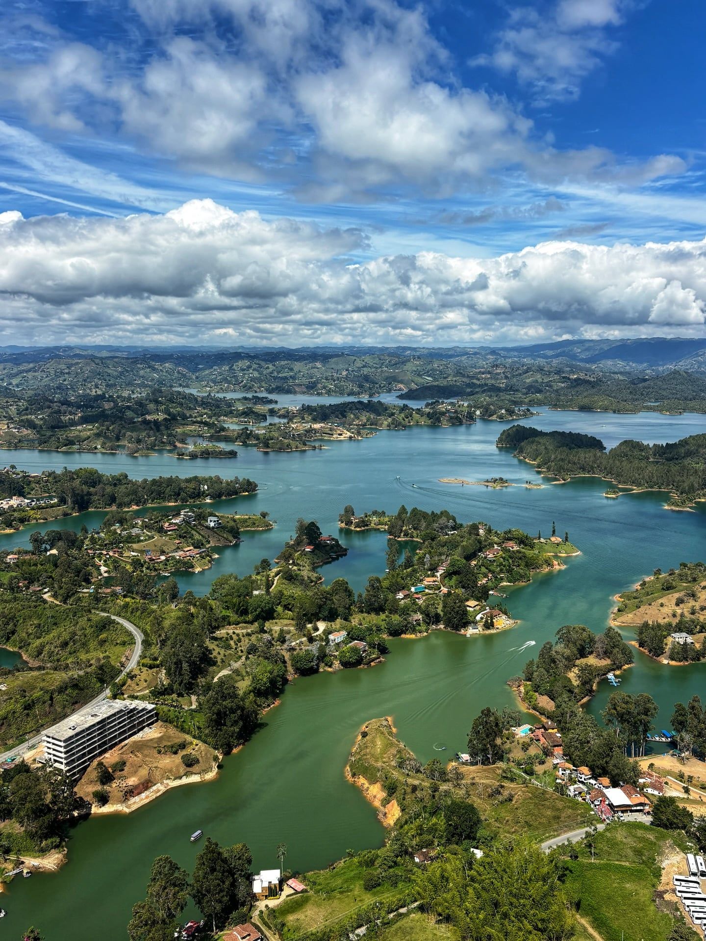
The surrounding Peñol-Guatapé Reservoir covers thousands of hectares, characterized by winding blue channels and hundreds of green peninsulas. The water maintains a cool temperature year-round, and swimming remains strictly prohibited due to safety hazards. Small boats and jet skis navigate the flooded valleys, passing over submerged roads and building foundations.
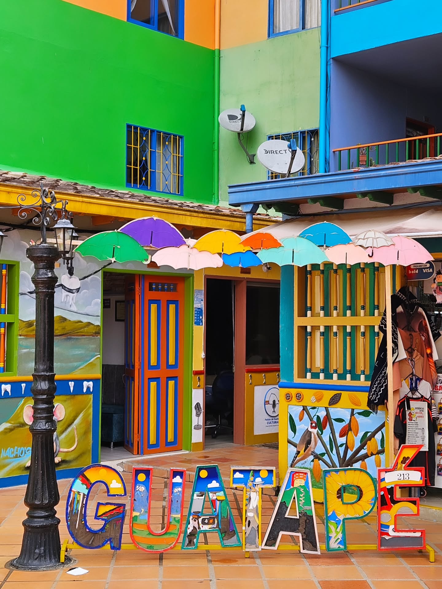
In the town center, architecture centers around the zócalos. These three-dimensional, hand-painted tiles wrap around the bottom meter of building facades. Plaster and cement form the bas-relief shapes, which are then painted in high-contrast primary colors. Calle de los Paraguas adds another layer of color with a canopy of suspended umbrellas shading the cobblestone street. The Plaza de los Zócalos features brightly painted tiered seating where locals gather. Visitors photographing these streets should arrive before 9:30 AM to capture the architecture without the interference of heavy foot traffic.
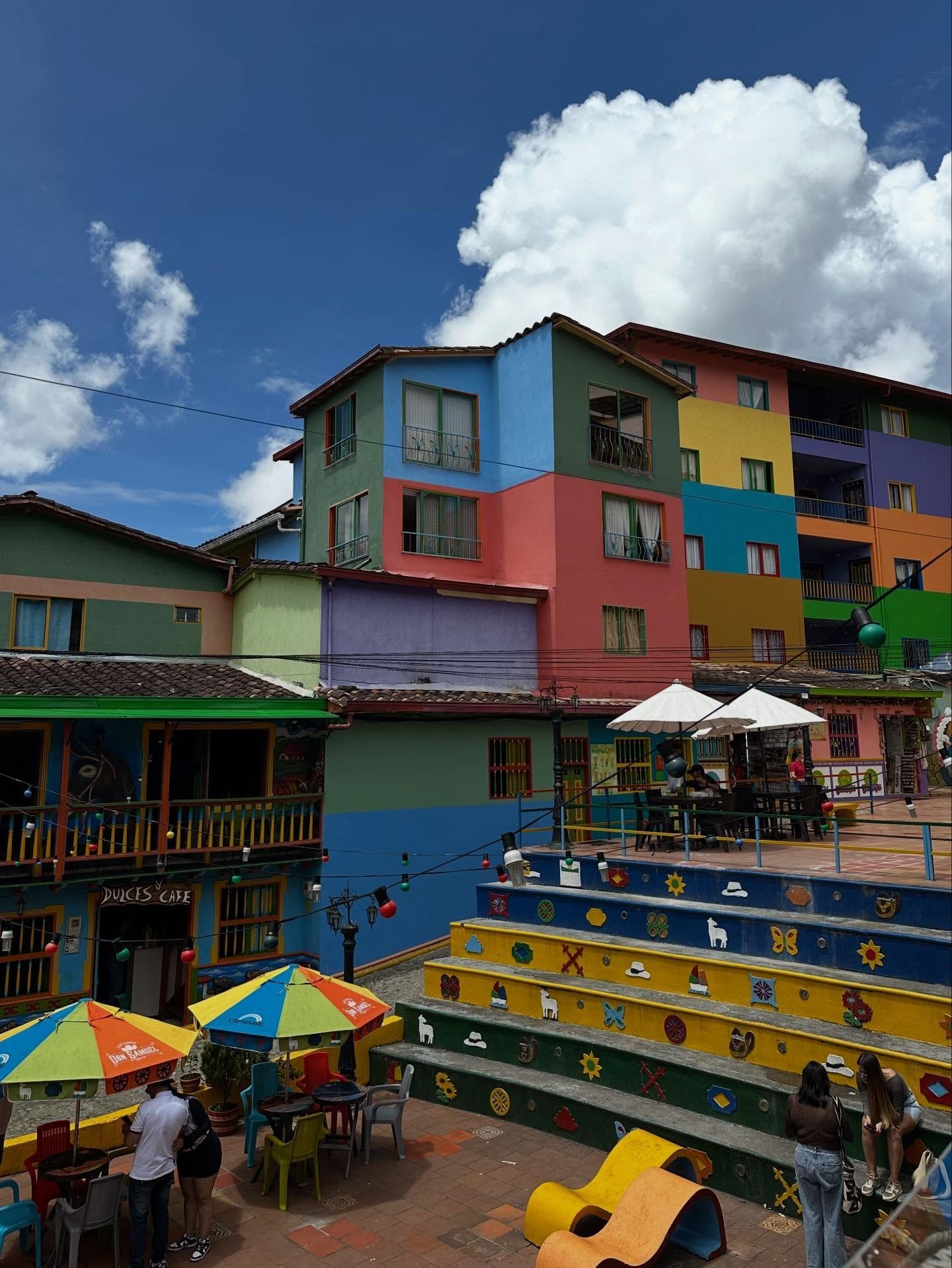
Guatapé's identity relies heavily on the preservation of its zócalos. These bas-relief tiles originated in the early 20th century as a practical way to protect building bases from moisture and roaming chickens. They quickly evolved into a visual storytelling medium. Homeowners commission specific designs to broadcast their profession, family heritage, or local folklore. A baker's house features raised depictions of bread, while others display sunflowers, llamas, or geometric patterns.
The 1970s flooding forced the community to actively protect this artistic tradition. Residents physically removed the original zócalos from their doomed homes and reinstalled them along Calle del Recuerdo in the new town layout. This act of preservation cemented the tiles as a symbol of local resilience.
The monolith holds deep historical roots for the region. The indigenous Tahamí people revered the rock long before Spanish arrival, viewing it as a sacred entity. Today, a shrine to the Virgin Mary sits halfway up the 740-step ascent, blending indigenous geographical reverence with Catholic tradition. Local vendors board public buses to sing or sell goods, a common practice that requires small cash tips in Colombian Pesos.
Two-thirds of the 65-million-year-old granite monolith sits entirely underground.
The town's name comes from a Quechua word meaning 'stones and water.'
The 740 concrete steps are anchored directly into a single vertical fissure on the rock's face.
A rare plant species, Pitcairnia heterophylla, was discovered growing exclusively at the rock's summit.
Zócalos originally served a practical purpose to protect plaster walls from dampness and pecking chickens.
The sprawling reservoir was entirely constructed in the 1970s to generate hydroelectric power.
Boat tours pass the bombed ruins of La Manuela, a waterfront estate formerly owned by Pablo Escobar.
The entrance fee is COP 18,000 to COP 20,000 (approximately $4.50 to $5 USD). Visitors must pay in cash using Colombian Pesos at the on-site ticket office. Skip-the-line tickets can be purchased online in advance for USD $18.
There are 740 numbered concrete steps built into the side of the monolith. A typical round-trip climb takes 1.5 to 2 hours.
No, the ticket office does not accept credit or debit cards. US dollars are also rejected, so you must bring local currency.
Swimming is strictly prohibited in most areas of the reservoir for safety reasons. Visitors can instead rent kayaks, paddleboards, or take guided boat tours.
Buses depart every 30 minutes from Medellín's Terminal del Norte at booth 14. The 79-kilometer journey takes about two hours and costs up to COP 17,000 one-way.
Zócalos are colorful, hand-painted bas-relief tiles decorating the lower facades of town buildings. They depict scenes of daily life, agricultural heritage, and the homeowner's specific trade.
Spanish settler Don Francisco Giraldo y Jimenez officially founded the town on October 4, 1811. The Colombian government later declared it a municipality in September 1867.
The town sits at an elevation of 1,890 meters (6,200 feet) above sea level. The high altitude makes the sun exceptionally strong, requiring high-quality sunscreen even on cloudy days.
Fully functional restroom facilities are available at the summit for both men and women. Small shops also sell cold drinks and snacks to climbers.
The concrete stairs become highly slippery and hazardous during heavy downpours. Visitors should wear secure footwear like tennis shoes and hold the safety handrails at all times.
Browse verified tours with free cancellation and instant confirmation.
Find Tours